
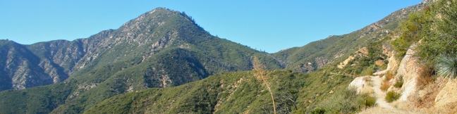
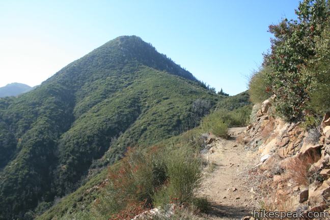
1.산행지: Mt. Smith . Coldbrook RS Area
2. Peak Elevation : 5,111 ft
3. Trail Head Elevation : 3,290 ft
4. Elevation Gain: 1,843 ft.
5. 산행거리: 6.6 Miles
6. 집합 장소: Trailhead
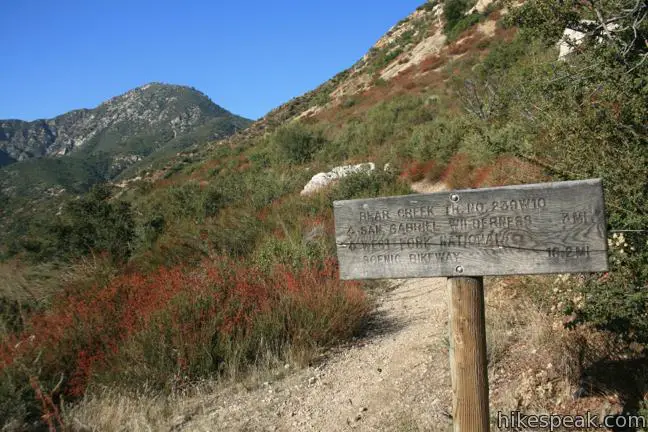
To get to the trailhead: From the 210 freeway in Azusa, take exit 40 and drive 18 miles north Route 39 to the trailhead. You will pass the East Fork Ranger Station at the base of the San Gabriel Mountains. Continue past San Gabriel Reservoir and go straight through an intersection with East Fork Road (the turnoff you would take to reach the Bridge to Nowhere hike). From the intersection, it is another 6.3 miles to the paved turnout on the left for the trailhead. (If you reach Coldbrook Campground, you drove 1/3 of a mile too far.) Upper Bear Creek Trail begins next to the bathroom at the north end of the lot.
Trailhead coordinates: 34.28738, -117.84267 (34° 17′ 14.57″N 117° 50′ 33.6″W)
7. 집합 시간: 8:00 AM
8. 문의사항: 준김 총무: 818-279-4505
안전산행을 위하여 모두 개인필수정비를 지참하시기 바랍니다.
무전기 , Headlamp , Trekking Poles , 방통, 방수되는 자켓, 장갑,비상식량, 충분한 물 등은 필수품 입니다
 Ontario Peak ...
 Twin Peak 산...